March 24, 2022
Cricket and I caught an Uber back up to Molino Basin Campground on the Catalina Highway, where we had hitched the previous day. Tucson would have been tough to hitch back out of, and the Uber was inexpensive. Ubers have made getting in and out of sizable towns so easy that it almost feels like cheating on a thru-hike, but I’m from the olden days of only hitching and begging rides.
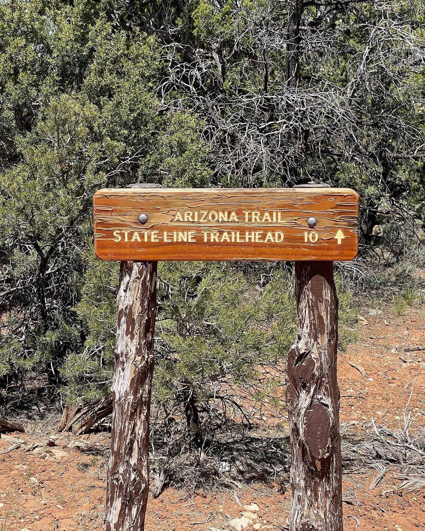
When we arrived back at the Molino campground, we hiked up to Gordon Hirabayashi Campground and went our separate ways. I had told Cricket that morning that I would be taking the Wilderness Bypass trail around the East face of Mt. Lemmon. The bypass was about the same distance as the traditional AZT, but I knew it would be less crowded for my introverted self, and I would not have to trudge through the supposed snow.
Honestly, I needed some solo time, and the trail appeared, although steep in sections, to traverse more of the high-altitude forests I loved. I could hike at my desired speed, stop whenever I preferred, and see fewer people. As we hiked up to the campground, I looked up the trail to see groups of hikers ahead of me. This confirmed I had made the right decision and that Cricket would have plenty of other hikers around her. Feeling better about my decision, we agreed we would meet up on the other side of the mountain in two days.
The only disadvantages of the Wilderness Bypass route were that there had been a wildfire two years prior, and water was scarce. Neither of these things was much of a concern for me. The forest would be returning, I would have stellar views through less vegetation, and I could drop down to the Hitchcock Highway and ask or plead for water from motorists if needed.
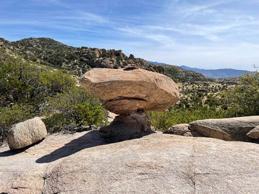
I turned out of Hirabashi and began switchbacking up towards some outstanding Hoodoo views. I always enjoyed hoodoos, and these would be the best I had seen on this trail. Once I reached the first hoodoos, I met two forest rangers, and we stopped to review maps for about a half-hour. They told me the easier route would have been the traditional AZT due to trail conditions on the bypass, but the bypass was still manageable.
Climbing was tough and hot as I wound through the hoodoos along the ridge and dropped back down towards General Hitchcock Campground. There was climbing between Hoodoo ridge and the campground – small weaving climbs in and out of washes covered with oak and pine/spruce. Much of the trail also followed a creek, a very dry no-water creek.
The climbs were not easy either, as steps had been created to help prevent erosion. They were steps made for giants or people at least eight feet tall. They were built with large timbers, and I angled towards the sides so I would not have to bring my knees to my chest to step up. These would have been fine at twenty, but at 54, my knees fussed.
Before the campground, I stopped to check my App for water sources. The heat had me drinking far more than usual, and as I looked around, I realized the desert was still the desert. I noted I would pass Green/Bug Trailhead and that the next water source after that appeared to be dry based on notes in Farout. There would be no more water until tomorrow.
I stopped for lunch above the Green/Bug trailhead and watched the parking lot for traffic. No cars pulled in while I was eating, so I crossed the highway to a day-use area and searched for a water spigot. Walking around a bend in the road, I saw a young man working on a mountain bike behind his open van.
Walking toward the biker, I said hello, and we chatted for a few minutes while he got me all the tap water I wanted from his van. I knew he spent a lot of time outdoors since he apologized for it being municipal water. When I find a good creek, I’ll dump my tap water out of town. Water in priority order – Spring, Creek, Town Water, Cow Shit Hole Pond, and the cow pond and municipal water are close. On the other hand, it was nice not to have to filter my water.
The biker lived in Tucson and would come up the mountain, where it was cooler, to work on his bikes during the summer. The van was his home part-time, and mountain biking was a big part of his lifestyle. We chatted for a few minutes, and I thanked him before walking to the trailhead. Wanderers were often kindred spirits, no matter how we chose to wander.
After General Hitchcock, the climbing increased, winding up among rocky outcrops and burned forests. However, the burn was offset by the views as I looked back down the mountain behind me. The trail felt as if it was mine. When I started, I had only seen one other trail runner and the two rangers, which had been several miles back.
Once reaching the Mt. Guthrie Trail intersection, the trail began contouring around the mountain’s east side. I wanted to get close to the summit and Summerhaven, so I continued to push a little since we had started later in the morning.
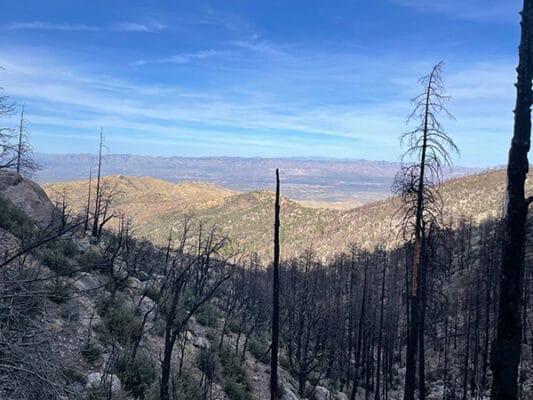
This entire side of the mountain was burned, but the burn was interspersed with living trees, and trail work had started. A few parts of the trail had crumbled away, but I could climb up and around them, only using my hands on several occasions.
As the trail wove around the mountain, there were numerous views from promontories and small plateaus where I stood and looked out over the San Pedro River Valley. These views were much nicer than looking out over Tucson on the other side of the mountain. Those views just made me think of town food. I smiled as I thought of the sunrises I would have tomorrow morning.
Reaching the end of Ten Mile Trail, I found a locked gate with a sign stating the trail I was hiking was “Closed for Public Health and Safety.” The rangers had not told me the trail was closed, so maybe it was an old sign, although several mountain bikers I met the next day also told me it had been closed since the fire.
It was getting late, so I slid my pack under the barbwire beside the gate, climbed over it, and stood looking at the trailhead below before I turned and began climbing steeply back up the mountain to find camping. Finally found a little flat spot far enough from the trailhead not easily to be reached, I settled into bivy camp on the ground.
My camp had fantastic views of the Tucson lights, and I sat on a large boulder eating dinner as I watched the light show and wondered how many of the lights belonged to restaurants. Hiker hunger had finally set in, although I now think it’s a permanent curse. I could hear traffic on the main road below, but the cars became infrequent and faster as it grew later. The road appeared to convert to a speedway late at night.
My sleep was interrupted by voices coming up from below. People had parked at the trailhead and begun hiking up the mountain. I was pretty sure they would stop at an overview near the gate, so I just lay watching small headlamps bob up the mountain, twinkling in and out of the inky blackness before stopping near the spot I had expected them to stop. Thank goodness, since there was only room for one to sleep where I slept.