
My Arizona Trail Resupply Plan included a mix of boxes and resupplying in town as needed. This is not just a repeat of what you can find under Gateway Communities on aztrail.org, but the plan I used and what did and did not work for me. I also describe what I may have done differently.
My hiking partner for the first few sections of the trail could not hike more than 15 miles, so it is based on a 15-day hiking schedule, which you can check out if you like spreadsheets.
This post takes you through my resupply plan and why I chose the location, I selected. I’ll also go through additional resources I used for the hike, like Apps, devices, planning guides, etc.
Table of contents
Additional Planning Tools – Arizona Trail Resupply Plan
- Gaia GPS – I use Gaia GPS for resupply planning and navigation. Gaia has topo maps, towns, side trails, service roads, etc., and more detail than Farout. It is easy to use, and I lay out my route and add waypoints for places of interest, towns, and where I want to exit the trail for my resupplies. Once I’ve created my map, I sync it with the Gaia GPS App on my phone.
- Guthook/Farout – This App has comments and notes on water, camping, shuttles, towns, etc. Hikers ahead of you enter information that you access. This is especially good for water and towns. You will need to download topo maps if you want to use them.
- AZT Trail Communities – The Arizona Trail Association has many good resources for hikers. In addition, this Gateway Communities list provides good town information.
- AZT Databook – You have access to the Databook if you are a member of the Arizona Trail Association. I use it for the water information and distance to towns. The annual membership is only $50 and supports your hiking trail. The data book is consistently updated, so get the latest version.
- Facebook – Join the “Class of XXXX” for the year you plan to hike. You get timely updates, information from trail angels, notices on fires, closures, etc. Expect some “spirited” discussion.
My Shipping Method
I use USPS Flat Rate Boxes for a few reasons.
- They are the perfect size for a 3-5 day resupply, and I can pack a lot in the flat rate boxes.
- I can return them for free if I need to send something home.
- They usually arrive in 1-3 business days.
- I can forward them one time if I need to bump something ahead.
Shipping Fuel on the Trail
Make sure you check the regulations before shipping fuel. This will ensure there have been no changes.
You also want to confirm you can ship fuel with your postmaster. Mine know the regulations and let me send the fuel, but some do not and will refuse the box.
These USPS regulations provide the information you need:
When I ship my packages, I place the language below on the address side of the box at the bottom in large bold letters.
ORM-D, Consumer Commodity, Surface-Only
Review the Regs. and talk to your Post Master before labeling and shipping your fuel.
Planning Documents – Arizona Trail Resupply Plan
The documents below are the spreadsheet I use for planning and a “Town Checklist.”
In the Resupply Plan Spreadsheet, there are three columns to the right. I use these for food planning. For example, I snack consistently between breakfast and dinner, stopping for breaks as needed, and don’t eat a formal “lunch.”
Feel free to reach out to contactaveraghiker@gmail.com if you have any questions or want a copy of the spreadsheet.
Resupply Stops
For Arizona Trail Resupply Planning, I had ten stops. Below are those locations, along with the location addresses.
1. Patagonia, AZ (Mile Marker 51.2)
Mile: 51.2
Day: 4
How I Got There: On Trail
Address: Post Office
Ellie Thomas
100 N. Taylor Ln.
GENERAL DELIVERY
Patagonia, AZ 85624
Post Hike Thoughts
This was an easy resupply because the trail went directly through town, but this is no longer the case. The reroute was being completed as we came through town, bypassing Patagonia, which I find unfortunate. The reroute comes out about 4.5 miles north of Patagonia on Route 82 and is a little longer than the old AZT.
The town of Patagonia is small and consolidated, so the perfect hiker town. People are friendly, and there are several good restaurants, a PO, a small convenience store/grocery store, a motel, and everything a hiker needs. The convenience store is large, and they have a lot of food that hikers need since they are very aware of thru-hikers. I stayed at the Stage Stop Inn, and Fresh Grounds, a few doors down, is excellent for breakfast.
2. Colossal Cave Park
Mile: 123.6
Day: 9
How I Got There: 1 Mile – Walk to Cafe (See Details Below)
Address: Colossal Cave Park via UPS or FEDEX
Colossal Cave Mountain Park
16721 E Old Spanish Trail
Vail, AZ 85641
Please hold for AZT Hiker Ellie Thomas ETA 3/XX/2022
Ship via UPS or FEDEX
Post Hike Thoughts
The easiest way to get there is to go to mile marker 123.6 in Farout. The trail will cross over a two-track road here, and you take a left onto the road. Walk down the road about a half-mile through the campground, and you will see a 911 sign on a pole. There is a trail just past the sign on the right. The trail switchbacks up the mountain about a half-mile to the cafe, where I picked up my box in the souvenir shop. The staff was super friendly, and there was a food shop outside that sold drinks, ice cream, pizzas, chicken strips, etc.
One note on Colossal Cave. I talked to several other hikers that had problems with their packages. Due to the volume of packages, Colossal Cave seemed a little overwhelmed with the volume at times, and a few boxes were lost. However, I did not have that issue, nor did the others hiking around me.
If I had not had a box at Colossal Cave, I would have hitched into Tucson from mile marker 111.2 to resupply. This was Sahuarita Road Trailhead and Highway 83. It was a very easy hitch, and I quickly got an Uber back to the trailhead.
3. High Jinx Ranch
Mile: 199.5
Day: 15
How I Got There: About 100 yards off the trail
Address: Ship to High Jinx Ranch via UPS or FEDEX
Ellie Thomas
C/O High Jinks Ranch
33550 S. High Jinks Rd.
Oracle, AZ 85623
Please Hold for AZT Hiker Ellie Thomas ETA 3/XX/2022
Ship via UPS or FEDEX
Post Hike Thoughts
I hiked through Summerhaven, but there was nowhere easy to stay, and everything was pricey. They are building a ton of rental cabins in town, though, so that may change. Everything opens late when it is open, so don’t get there early. The General Store opens at 10 AM and has a decent resupply. They also give hikers a good size-free coffee or hot chocolate.
High Jinx Ranch is right near the trail. Even if you are not staying, it is a nice place for a break. If you are staying and shipping a box, they have a room with 2 Queens and 2B/1BR and a suite with two couches. They charge $8 for your resupply box and want you to call or DM them and let them know you are sending a package.
Many hikers went into Oracle, where there are B&B-type accommodations. There are also several restaurants, a PO, convenience stores, and a Dollar General. I chose High Jinx Ranch because it was different and on the trail.
The stay was good, and the views from our Casita were terrific! The owner also took us into town because she had some time, but this is not guaranteed.
I would not change this stop.
4. Kearny Arizona
Mile: 262.1
Day: 20
How I Got There: Hitchhiked
Address: Post Office
Ellie Thomas
388 Alden Rd.
GENERAL DELIVERY
Kearny, AZ 85137
Please HOLD for AZT Hiker Ellie Thomas
ETA 4/XX/2022 (Date XX for privacy)
This was one of my favorite town stops. I stayed at the General Kearny Inn and had pizza every day! The town is small but has a very good grocery store, motel, and Pizza restaurant. The people are also incredibly friendly. While sitting out front of the Pizza restaurant, I had three people ask me if I needed a place to stay. Finally, the pizza restaurant owner gave me a ride back to Florence-Kelvin Road Trailhead.
The General Kearny Inn is the only motel in town and fills up fast. Make reservations at the town stop before Kearny. By then, you will know how fast you hike and when you should arrive in Kearny.
There are two trailheads you can use to get into Kearny. If you are going NOBO, the first one is Florence-Kelvin Road Trailhead. There were two people there when I arrived that offered a ride into town. It appears to be busy on the weekends but not so much during the week. If you have a signal, call Old Time Pizza, and someone will probably come to pick you up. The owner, Gary, likes the hiking community and enjoys helping hikers.
Many hikers use the Gila River Trailhead. If you don’t have a cell signal at Florence-Kelvin, call Old Time Pizza on your way down to the Gila River.
5. Roosevelt Lake Marina, Arizona
Mile: 337.8
Day: 26
How I Got There: Walked
Address: Roosevelt Lake Marina (Ship via USPS)
Roosevelt Lake Marina
28085 N. Hwy. 188
Roosevelt, AZ 85545
Please hold for AZT Hiker Ellie Thomas
ETA 3/XX/2022 (Date XX for privacy)
Cricket got sick, and we went into Superior for the night. We hiked in from Picket Post Trailhead and stayed at The Copper Mountain Motel. The trailhead was nice and had plenty of traffic, so getting a ride from a day hiker was easy.
The Marina has struggled with its hiker relationship, but that seems to have changed this past year. They now have a hiker shack and picnic table to hang out and charge devices. In addition, you can supposedly camp in the parking lot, and some campsites are nearby.
The Marina also has a bar and restaurant with good food and friendly staff. If you send a box for them to hold, ensure you time it well because they hold them for about two weeks after the ETA date. They also charge $10 to pick up your resupply box.
Roosevelt Lake Marina Post Hike Thoughts
My box was sent to the wrong Marina (no comment), but they definitely hold boxes and still charge $10 to retrieve it. The staff is friendly, and we had decent lunch and dinner. I could get enough food from the hiker box, but the store was minimal. I got a few snacks, but that was about it, so I would not plan to resupply in the Marina store.
We camped in the small field they had for hikers, but many hikers did not get much sleep between the party group and the dog barking across the street. I always carry earplugs.
Hikers with dogs need to keep them on a leash. I got yelled at about loose dogs a couple of times even though the loose dogs did not belong to me.
If I were to resupply here again, I would send a box and have a meal, but I would move on to camp up the trail. There are spots for camping not far up the trail.
6. Payson, Arizona
Mile: 383.3
Day: 30
How I Got There: Taxi from Pine Trailhead
Address: Post Office
Ellie Thomas
100 W. Frontier Street
GENERAL DELIVERY
Payson, AZ 85541
Please HOLD for AZT Hiker Ellie Thomas
ETA 4/XX/2022 (Date XX for privacy)
It is approximately 117 miles between Kearny and Pine, so we will hitch into Payson, about 32 miles away. We will get off in Sunflower. There are a couple of shuttles in Guthook/Farout, so we will reach out to them, and if we can’t get a ride, we will hitchhike.
Payson is a larger town and has plenty of chain motels and restaurants. It is closer to get there from Pine, so if you can’t find a place to stay in Pine, you can hitchhike to Payson.
Payson Post Hike Thoughts
This and the Pine stop changed. We hiked to Sunflower, and some friends picked us up to resupply in Phoenix. Sunflower is not a town but a crossing over the highway to Payson and Phoenix. We got there the night before being picked up to go to Phoenix, so we hitched up to Payson for dinner. It was a long hitch, and it took us about 20 minutes to get a ride since the traffic was moving so fast.
We caught a taxi back to Sunflower after dinner. It was expensive, but hiker hunger is powerful.
If I did not have friends in Phoenix, I would still have resupplied in Payson, AZ. However, the hitch is tough, so I would probably have called the Taxi.
7. Pine, Arizona
Mile: 455.1
Day: 36
How I Got There: I would have walked
Address: Post Office
Ellie Thomas
3847 N. Highway 87
GENERAL DELIVERY
Pine, AZ 85544
Please HOLD for AZT Hiker Ellie Thomas
ETA 4/XX/2022 (Date XX for privacy)
Pine is only about a mile off the trail. We may or may not stay over since we are staying in Payson. Payson has more amenities, but you can book Air BnB’s in Pine.
Pine has several restaurants and retail shopping needed to resupply. “That Brewery” is the most well-known spot for hikers in Pine and seems to be a popular hang-out for hikers and locals.
Payson Post Hike Thoughts
When we got to Pine, we took the same Taxi to Payson. We scheduled it the day before. Payson is far more extensive than Pine and has a lot more services. However, Payson is not that far from Pine, so the Taxi was not expensive.
I ended up staying at the Best Western, had a good breakfast, and was close to everything I needed – grocery store, restaurants, etc.
Pine is a nice little walkable town, but there is not a lot in town and no good motels or hostels.
8. Mormon Lake, Arizona
Mile: 521.5
Day: 41
How I Got There: Walked
Address: Post Office
Ellie Thomas
1 Mormon Lake Road
GENERAL DELIVERY
Mormon Lake, AZ 86038
Please HOLD for AZT Hiker Ellie Thomas
ETA 4/XX/2022 (Date XX for privacy)
Although we will be early in the season, there is a post office. There is a lodge and restaurant, but reportedly the restaurant only has limited weekend hours. The store has regular hours but reportedly closes at 3 PM outside of the season.
The lodge is open, and there should also be showers where you can charge your devices. I don’t know if we will stay here, but we will grab a box and visit the store.
Payson Post Hike Thoughts
I was hiking solo at this point, so I did not stay overnight in Mormon Lake. Instead, I picked up my box, ate a very good breakfast at the restaurant, and hiked the mile back up to the trail again. The restaurant seems to have erratic hours, so call from the town before and ask when they are open.
Although there are cabins here, I would have done the same thing again. The one-mile hike down was easy.
9. Flagstaff, Arizona
Mile: 573.2
Day: 45
How I Got There: Walked
Address: Post Office
An alternate trail takes you through Flagstaff and is a shortcut that bypasses about 13 miles of the AZT that runs east of Flagstaff. The alternate takes you through town and is well-marked and easy to follow. If you want to stay on the trail, you can still access Flagstaff, walk into town, or call an Uber.
Flagstaff has several grocery store options, health food stores, and outfitters, including REI. I won’t be sending a box to this location but will resupply in town.
Hotels, motels, and all amenities are available in Flagstaff, and I plan to take a zero here.
Payson Post Hike Thoughts
There was a wildfire outside Flagstaff, and everyone was advised to hike through town. If there had not been a fire, I would have stayed on the trail, but it appears most hikers take the urban trail into town.
The walk into town was easy, and I stayed at the Holiday Inn Express, about a half-mile from the trail. I used an inexpensive Uber to run errands, and several restaurants were within walking distance of the hotel. There is no lack of places to stay in Flagstaff.
10. South Rim or Tusayan, Arizona
Mile: 675.4
Day: 54
How I Got There: I walked
Address: Visitor Center (SHIP VIA UPS OR FEDEX ONLY)
Grand Canyon National Geographic Visitor Center
450 Route 64
Tusayan, AZ 86023
Please HOLD for ATZ Thru-hiker – ELLIE THOMAS
ETA 4/XX/2022 (Date XX for privacy)
There are a couple of options here. First, I will go to Pasayan and have my box shipped to the visitor center in Tusayan. This is supposedly a costly town, but I think I will have more options if I need anything before wrapping up the hike.
The next day I’ll walk over to the Grand Canyon Visitor Center and General Store and stay at Mather Campground before entering the Grand Canyon. They have some walk-up hiker campsites. This is a good place to catch up with other hikers you have met that are also finishing.
You can also send your box to the visitor center/store, and they supposedly have a very good store with reasonable prices where it is easy to supply.
The visitor center is also where you want to coordinate your Grand Canyon camping permits, although this past year, they wanted you to send an email no more than 72 hours in advance, and they would call you back.
Post Hike Thoughts
If doing this again, I would camp outside Tusayan and go in for breakfast. The hotels are expensive. Every hiker goes straight to MacDonald’s, but Plaza Bonita is right across the street and has a buffet or very good menu breakfast. It is much better than Mickey’s.
I shipped a box to the Visitor Center, but they don’t accept packages on the weekends, and FedEx was also a day late, so I returned the box. It is now a month later, and I’m still waiting for my package from FedEx.
After breakfast, and maybe lunch, I would walk over to Mather’s Campground and get a campsite. There is plenty of room in the hiker/biker area, where most hikers stay. I got a tent site for a bit of peace and quiet. The sites fill up fast but ask them if they have any admin sites that employees use. They will give you one if they are vacant.
11. Final Stretch
Mile: 779.3
Day: 63
How I Got There: Walked
I’ll probably reach the North Rim too soon to resupply. Facilities open on May 15th. After that, I’ll plan to hike straight through to the state line.
I will get a permit at Bright Angel Campground in the Grand Canyon. It is next to Phantom Ranch, where I can get snacks and maybe even a meal if I’m lucky.
Post Hike Thoughts
The permitting process was easy. After lunch, I went to the backcountry office and got a permit for Bright Angel and the campground on the North Rim. If you are not in a group and get your permit the day before, you can probably get Bright Angel instead of Cottonwood, although after seeing them both, I thought Cottonwood was a better location and would have preferred staying there. It was cool to be near Phantom Ranch, though.
I ended up staying at the North Rim Campground because there was no camping for the next 12 miles after climbing up from the Grand Canyon. They were nice campsites, but nothing was open yet.
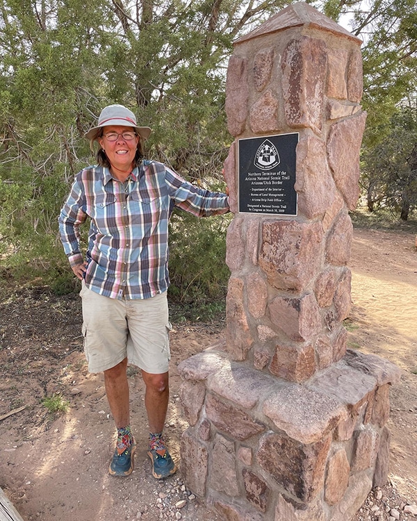
I reached the Utah border late in the day and stayed camping at the campground with some people. There are not many campsites, and they fill up fast. The following day I walked up to the main dirt road and turned left towards Wire Pass.
I walked for about an hour before the only car my way gave me a ride to Page, AZ. You will have much better luck if you hitch in the afternoon when everyone is leaving Wire Pass. The worst case is you have to walk ten miles to the highway, where it should be an easy hitch.
I booked a flight from Page to Phoenix on Contour Airlines. Unfortunately, they no longer have any flights to Las Vegas. When I arrived at the airport, I decided to ask if they had a one-way car rental to Las Vegas. They just happened to have one car. They will tell you no if you call, but they might just have a car if you ask in person. I got a credit on my flight, drove to Las Vegas, and had fun along the way.
I could have stayed in Kanab instead of Page, I would have, but there was no easy way out of Kanab to a major airport. I liked the town more and stopped at Wild Thyme while driving to Vegas. I was impressed with my lunch – good food!
Final Thoughts – Arizona Trail Resupply Plan
I did not find resupplying on the Arizona Trail particularly difficult, and it was easy to get into most towns. There were some locations where I needed a box – Colossal Cave, High Jinx, Roosevelt Lake (and possibly Pine), but the other towns had stores and supplies.
If you want to wing it, I don’t think you will have a difficult time. There are many towns, and the locals are helpful, so it is easy to hitchhike. I prefer to do at least some planning on my hikes. My schedule is always flexible, and it makes for a much less stressful hike. Over the years, I’ve wasted more time “winging it” than if I had planned.
HI, WONDERING IF HITCHING FROM ROOSEVELT RES, 19 MILES TO THE DOLLAR GENERAL IN TONTO BASIN IS BETTER/CHEAPER THAT SENDING A BOX THERE.
ALSO A PIZZA AND SUB RESTAURANT THERE IN TB
Hi
I’m not sure since I did not do that.