New England Trail Planning
The New England Scenic Trail (NET) is a 215-mile hiking trail that travels through 41 communities in Connecticut and Massachusetts. The NET comprises the Mattabesett, Metacomet, and Monadnock Trail systems. The NET was designated a National Scenic Trail on March 30, 2009.
There have been two main changes to the route since it was designated in 2009. These include the following:
- A 4-mile extension to Long Island Sound in Connecticut.
- A 22+ mile eastward deviation from the historic Metacomet-Monadnock Trail in Massachusetts.
Trail Planning
The New England Trail (NET) has a good website that provides several resources for planning your next hike on the NET.
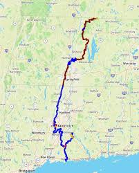
- Map – This is an interactive map
- Find A Hike – Find a hike near you
- Closures and Notices – Updated trail conditions
- Overnight Sites – camping shelters and tent sites
Navigation & Logistics
The screen shot above provides very useful information from the NET website. Go to the “Get On The Trail” menu item, as seen above, and select “All Section Hikes” in the drop down menu. Once you select these, you will land on the screen above.
As you can see, there is useful information for determining the location of your hike, and how to successfully navigate the trail. You can print your maps by selecting “Print Trail Map,” and also see the location and miles for the section.
The three tabs in on the page above will provide you with the itinerary for this section, a view of the map, and locations for parking and overnight sites. Choose the “Show Parking & Overnight Sites” tab and click on the small blue icon for the trail head where you want to start and park (see screen shot below).
Once you click on the small blue icon, you will get the pop-up above. This box contains additional trail head and parking information. On the pop-up, select “Get Directions” in blue.
Below is a screen shot of the page after you click on “Get Directions.” There are two sets of coordinates. There are the larger ones, and then the smaller ones underneath the larger numbers (42.715702,-72.255514). Put these coordinates in Google Maps exactly as they appear, and your GPS will direct you to the trail head. Gotta LOVE technology!
New England Trail Sections & Trip Reports
The NET website provides all of the sections available for hiking, along with their Section numbers. They are not listed in order, and can be a little confusing, so I will list the trails with a brief description below.
I will also include a link for those sections I have hiked. The link includes the Trip Report which describes the section, and supporting pictures.
Metacomet – Monadnock Trail (Sections 01-19)
This section of the New England Trail traverses Massachusetts.
Metacomet Trail (Sections 14-21)
This section of trail runs from the northern border of Connecticut to South of Hartford near Berlin
Mattabesett Trail (Sections 1-4, 9-13)
Sections 9-13 run from south of Hartford to where the Mattabesett intersects with the Menunkatuck Trail. Sections 1-4 of the Mattabesett then travel northeast up to the Connecticut River.
Section 01 – Trip Report & Pictures
Section 02 – Trip Report & Pictures
Section 03 – Trip Report & Pictures
Section 04 – Trip Report & Pictures
Menunkatuck Trail (Sections 5-8)
These sections of the trail travel from the intersection with the Mattabesett Trail, south to Long Island Sound and the town of Guilford, CT and the southern terminus of the NET.