Looking down at the motel room carpet, I realized the mountains would probably have been cleaner. Dirty carpet with dust, hair, and other debris packed into the corners made me reach out and drag my shoes towards me. They would go on my feet before I touched the grimy carpet.
Samantha and Shy were going to meet me downstairs, where her boyfriend and his son would give us a ride back to Tennessee Pass after we all went to breakfast.
Coffee is all I really remember. The rest of the food was tasteless and in small quantities. The BEST town mornings were when I found a “local” breakfast joint or a good ole Jersey type Diner. Leadville appeared to be going through some minor gentrification and the food reflected the transition. In all fairness, I did not look too hard.
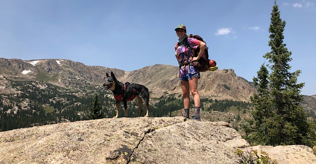
I literally fell out of Sam’s SUV at the trail head as a mass of dogs shoved me out of the way. Hair, claws, slobber – I laughed as I tumbled onto the dusty parking lot with my backpack falling down on top of me. I love dogs!
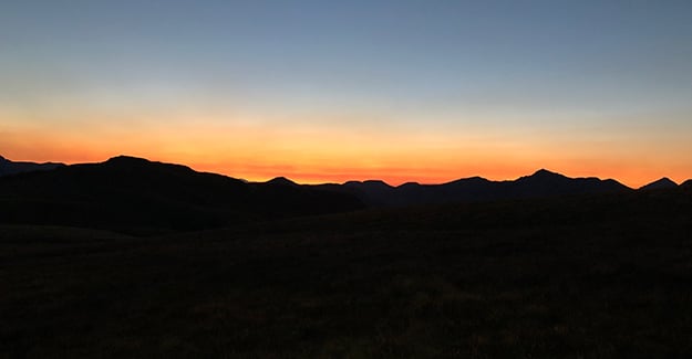
It was a hot, clear, smokey morning, and Sam, Shy and I were ready to go. Poor Alfredo had driven 5 hours to bring Sam a warmer sleeping bag and barely got a goodbye as we all charged off into the woods. Food and comfort drew me to town, but the unknown always pulled me back to the mountains.
I breathed in the thin mountain air, feeling the tickle of gritty smoke at the back of my throat. Frowning, I looked out over the flashes of mountains between the spruce trees. Where were the fires? I should have checked in town. They seemed to be getting closer, at least the smoke was definitely getting thicker.
Our goal was 15 miles for the day. Since we had started late morning, this would be a long day for Sam and Shy. Prior to Leadville, 15 miles was about their max daily mileage, while mine was around 20 miles per day. The days of “crushing” the 30+ mile days were over. I could still hike them, but my priorities had changed. I now enjoyed a more relaxed pace.
We passed a large group of hikers before rounding a bend and finding a friendly thru-hiker named “Do Over.” He had stopped to make some calls before losing his cell signal. Interestingly, the “Guthook” App seems to offer information on water, campsites, and more recently – cell signals. Times have changed.
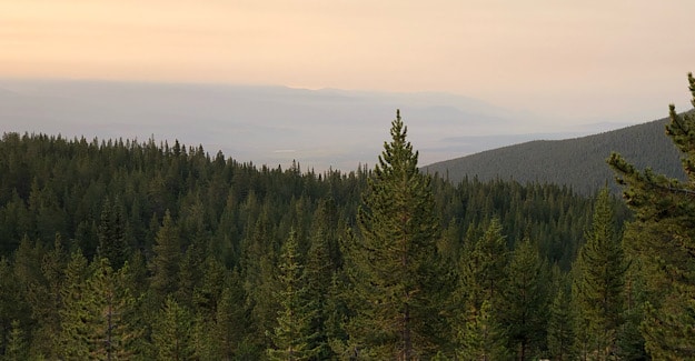
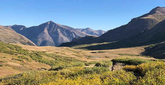
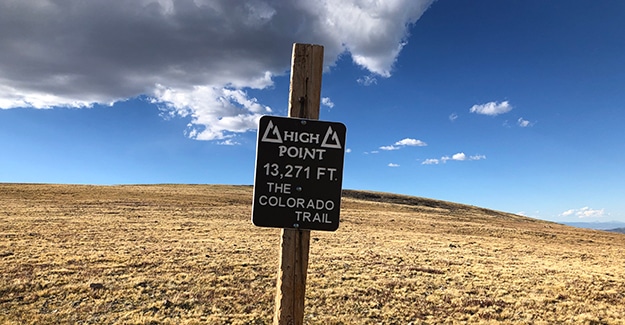
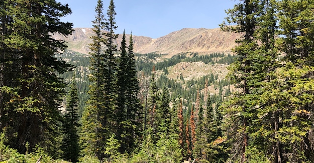
The climb up out of Leadville was dusty, dry trail with surrounded by large, old Spruce trees. We looked out across the ridges as we climbed, and as we moved up towards 12,000 feet we transitioned to more of an alpine zone.
The climbs were fairly moderate with a few steep sections, and I smiled as I slowly “turtled” up the mountains. I was not sucking in the high altitude air as sharply and my constant headache and mild nausea were fading away. Going from sea level to mountain altitudes was tough, but two weeks later I was finally adjusting. In my twenties it took 2 days. Now it was closer to two weeks. Ouch.
The clean spicey smell of the Alpine Spruce helped to cut the smoke a little, and it was still a beautiful summer day. We passed horseback riders, and I marveled at the horses abilities to descend over some of the rocky trail we had climbed. I never cease to be amazed at some of the places I see hoof prints – places I can barely climb!
We scrambled up onto large boulders, talking and making plenty of noise to alert the horses to our presence. Sitting up high, we chatted with the riders as they passed by below us. Shy stood near Sam, letting out a low rumble as the large animals trudged slowly past her. So many new sights and smells. This was a dog’s paradise!
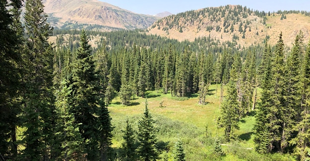
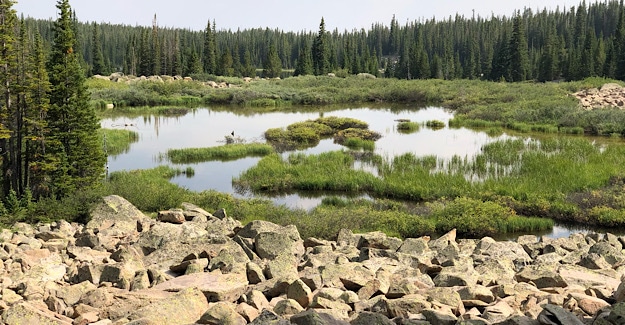
Later in the afternoon we made our way down past a small lake where we met some section hikers camped for the evening. There were great camp spots around the lake, with no bugs, but we still had several hours of daylight.
Checking my water sources, I picked Glacier Creek as the stopping point for the evening. This would put us at about 14 – 15 miles, and the water appeared to be flowing well, at least according to “Guthook.”
Although I did not see any campsites before Glacier Creek, I grabbed my water for the evening and drank about a half liter. I don’t usually drink water close to bedtime. My quilt is a bit of a hassle to get in and out of, so I try not to go to the bathroom at night.
End of the day water usually consists of drinking a half liter to one liter at my last water stop, and then carrying what I need for the night and morning. I need one liter for dinner along with cleaning and drinking for the evening. If there are easy water sources within 5 miles of camp the next morning then I will usually only keep another half liter for the next day, if that.
There was one small sloped campsite on the other side of Glacier Creek, so we hiked about another half mile before leaving the trail and finding a flat area up against the mountain. It appeared to be an old homestead site, and Sam went over to see if she could set up her tent in the foundation of the old cabin.
Unfortunately, there was rusted metal debris sticking up from the soil in the foundation, and oddly, under the metal, she found maggots. Gross. She moved back across the site and found another flat spot as far from the spooky old foundation as possible.
Samantha also hung her food since we saw bear claw marks on several trees.
This was definitely NOT an ideal camping spot, but it was late and we were already in “settled mode” for the evening.
The dank, heavy wet air seemed to settle down over the camp. I lay under my quilt watching the smokey night sky transition from grey to black. It was dark, a pitch black night. This was definitely in the top three of “Spookiest Places Camped on the CT so far.”
Related Posts: Colorado Trail Page
Daily Short Stats
- Miles Hiked: 14.7
- Day Temps: Upper 70’s
- Night Temps: Mid 40’s
- Hiking: Moderate to Hard
- Challenges: Smoke getting thicker
- Dinner: Outdoor Herbivore Basil Walnut Penne with Tuna – 3.5/5 Stars
- Lunch/Snacks: Tortillas with Nathan’s/Honey Almond Butter, mixed nuts, trail mix, cheese-its
- Breakfast: Peak Refuel Strawberry Cereal w/powdered milk – 4/5 Stars – good but not as filling as I would like, although more filling than regular cereal.