
The Chatfield Trail is a 4.3 miles trail that travels through Cockaponset State Forest and Forster Pond State Park. There are also some private lands, so you must stay on the trail.
There are trails north of the Chatfield Trail in Chatfield Hollow State Park, so you can potentially extend your hike along this trail.
I hiked the entire trail but took another route and hiked back approximately 9 miles. The hike was rocky, with mixed terrain, and fairly challenging.
Table of contents
Summary
- Location – Across from Chatfield Hollow State Park
- Trail – 4.3 miles one-way trail
- Parking – 41.36448,-72.58399 – I parked across the street from Chatfield Hollow State Park trailhead. There are two parking lots, and you can see the Chatfield Trail across the road.
- Getting to the Trail – Park and walk across Route 80. You will see Chatfield Trail and a small footbridge.
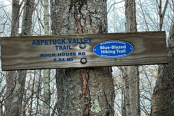
- Highlights – Boulders, Rock ledges, rolling wooded trails, small rock scrambles, nice streams
Resources
- Connecticut Walk Book – 20th Edition by the Connecticut Forest & Park Association – American Legion and Peoples State Forest Trail – Pages 38-41.
- Gaiagps – GPA App used to create a trail, determine driving directions and parking, and send the track to iPhone.
Difficulty
Moderate to Easy – All of the rocks, combined with some small climbs, made this more moderate. Leaves also made the hiking tedious since the trail was so rocky, and you needed to pay attention to foot placement.
Terrain – The terrain was wooded with rocky tread and rock formations. The first 2 miles were the hardest section of trail with the most elevation and rock scrambling, and the last mile near the Deer Lake Boyscout camp and along Chatfield Hollow Brook were the easiest.
Clothing
Temperatures ranged from 33 – 42 degrees, a pleasant day for hiking.
- Socks – Mid-weight Darn Tough hiking socks.
- Pants – Cotton workout pants. Nice weather, so not worried about cotton.
- Top – Light-weight Smartwool base layer, 100-wt fleece jacket, Feathered Friends EOS Hooded Puffy Jacket (Review). I ended up hiking in the fleece and base layer because the climbing warmed me up.
- Hat & Gloves – I did not use either for this hike.
- Northface Daypack – This article describes what I carry in a daypack.
- Shoes – Speedgoat 4’s (Review). These worked well in this terrain. The leaves would have been a challenge for any shoes or boots. They were slick!
- Hiking Poles – Black Diamond Alpine Carbon Cork Poles (Review) – This is my second set. Unfortunately, I left my first set in a town along the Northville-Placid Trail.
The Hike
As mentioned above, I parked across the street from the northern terminus of the Chatfield Trail in the parking lots for Chatfield Hollow State Park. Both parking lots were full when I returned in the early afternoon, so this appears to be a popular state park, although I saw no other people on the Chatfield Trail.
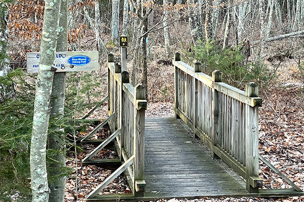
Crossing Route 80, I came to the beginning of the Chatfield trail and crossed a small bridge before turning right and hiking down a marked blue blaze trail. The trail is well-marked, but pay attention to the turn-offs and don’t take what I call the double-marked trails or those with multiple colors like blue and yellow or blue and red. These are alternate side trails.
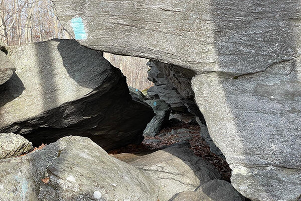
The first few miles on the Chatfield have many rock features like “Big Rock Shelters,” where you have to take off your pack and slide up under an overhang. Several sections travel under large slabs or overhanging rock.
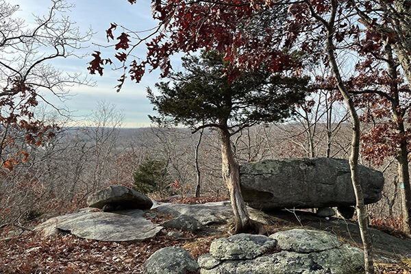
There are also some nice glacial features with large boulders along the first couple of miles, and some nice ridge views through the bare winter trees.
Between Big Rock Shelters and Champlin Road, you will encounter some rocky terrain and more strenuous elevation gain and loss, picking your way down a few rock and steep sections of trail, but if you take your time, it is not difficult.
Champlin Road is only about .2 miles before you reach a private residence and turn back into the woods near a small creek. You will cross a low-lying, wooded area before climbing back up over the hills across a clear-cut area along an old woods road.
After crossing the clear-cut, you drop down through some more rock features and continue past Deer Lake Boyscout camp. It is a large camp so expect activity if you are hiking during the season. On a positive note, though, walkways and bridges in the area appear to be well-maintained.
After passing the camp, you will hike down to Paper Mill Road and follow the road for about 100 yards before exiting to the right and following Chatfield Hollow Brook before meeting and ending at River Road.
Upon turning around, I followed the Chatfield Trail back until I reached the Boyscout Camp, which is closed for the winter. I cut across the camp and picked up an orange trail that dropped me back down at Chatfield Trail just before Champlin Road.
Instead of taking the Chatfield Trail and circling back through all the rock features again, I took a side straight up from Champlin Road, climbed up over the hill, and went about a mile down to Route 80, where I cut over to the Chatfield Trail and headed back to the parking area.
Final Thoughts
The Chatfield Trail provides varied, rocky terrain with glacial features and few rock scrambles and squeezes. You travel through hardwood forests and along babbling creeks along the second half. it is not an easy hike, but not much harder than moderate.