Desolation Loop Trail Summary
The Desolation Loop is located on the eastern side of the Pemigewasset Wilderness in the White Mountains of New Hampshire. This is a series of moderate to strenuous trails, including several 4,000-footers river crossings, and it is a lightly maintained and rugged trail. Several options are available on this loop, but hikers should have a good backpacking experience regardless of the trails chosen.
Desolation Trail Loop Highlights
Mount Hancock 4,406
Middle Hancock 4,278
South Hancock 4,318
Mount Carrigan 4,665
East Branch Pemigewasset River
North Fork River
Sawyer River
Thoreau Falls Shoal Pond
Desolation Loop Trails Followed (Sequential)
Hancock Notch Trail: 1.8 mile – Day 1
Cedar Brook Trail: 0.7 miles – Day 1
Hancock Loop: 4.8 miles – Day 1
Cedar Brook Trail: 4.8 miles – Day 1
Wilderness Trail: 1.5 miles – Day 2
Thoreau Falls Trail: 5.1 miles – Day 2
Ethan Pond Trail 0.5 miles – Day 2
Shoal Pond Trail 4.0 miles – Day 2
Carrigan Notch Trail 5.3 miles – Day 2
Signal Ridge Trail 5.0 miles – Day 3
Sawyer Pond Road 2 .0 miles – Day 3
Sawyer River Trail 1.2 miles – Day 3
Hancock Notch Trail 5.1 miles – Day 3
Hancock Notch Trail 1.8 miles – Day 3
Desolation Loop Planning & Logistics
A couple of initial notes on planning a backpacking trip for hiking the Desolation Loop.
- SectionHiker has a good Trip Report for The Desolation Loop Hike. I used his report to begin my initial planning for this backpacking trip.
- Unfortunately, I did not have paper maps for this hike. I like to carry them as backups and did not realize the USFS offices were closed due to Covid until arriving in New Hampshire. I don’t like relying only on electronics in the Backcountry, but I did on this hike.
Maps, Apps & Guides
As stated above, I did not have paper maps on this hike. If I had carried them, I would have used those below. I also listed additional maps and guides if you consider hiking in the White Mountains. There are ** next to those for this hike.
Guthook did not have this particular region available to download, so I laid out the Way-points on my GAIA GPS App. All trails were listed on the App.
- White Mountains Trail Maps 3-4**
- AMC White Mountain Waterproof FULL Map Set
- AMC White Mountain Guide (2017ed)**
- GAIA GPS App**
- Guthook App (Maps Not Currently Available)
Mileage
I started the trail on Monday @ 12:30 PM and finished on Wednesday at 12:37 PM. Unfortunately, I could not climb Mount Carrigan due to time limitations. So instead, I hiked Carrigan Notch Trail, which went over a lower pass next to Carrigan Mountain. This added some mileage but allowed me to make up some time on a more moderate trail.
Total Miles Backpacked = 43.6
First Day – 12.1
Day Two – 16.4
Day Three – 15.1
Parking
Coordinates: 44.04118, -71.52351
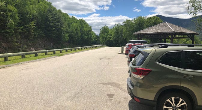
I parked my car @ Hancock Notch Trailhead. This is a frequently used parking area, and a popular observation point along the Kancamagus Highway, so get there early.
My car was fine when I returned, and this parking area is frequently used for overnight parking. However, like any parking area, break-ins can occur, so don’t leave valuables in your car and make sure it is locked.
Regulations & Permits
There are no permit requirements for this hike. However, review the regulations for Backcountry camping below.
Backcountry Camping Rules – White Mountain National Forest
Camping & Water
There are plenty of wilderness camping locations for backpackers. Organized camping locations can also be found below, but they are not directly on the trail and vary in distance. As with all camping, please practice LNT principles.
- Ethan Pond Shelter and tent sites (Pay)
- Sawyer Pond Shelter and tent sites (Free)
The USFS advises filtering or boiling all water sources. I carry a Sawyer Squeeze Filter and have a review of my filter.
Desolation Loop – Hiking
My decision to backpack the Desolation Loop this week was spontaneous. Looking at the weather for New Hampshire last Friday, there was a long column of bright sun emojis on my weather app. Even better, temperatures were in the high 70’s during the day and the low 60’s and 50’s at night. It was going to be GREAT backpacking weather!
The other reasons for my decision to backpack this week were twofold…
Test new gear
Test old Ellie
I’m still holding out hope that I will be able to hike the Colorado and Arizona trails at the end of this year, and I’ve been working on getting in shape.
The Desolation Loop looked like the perfect test with its 5/5 difficulty rating. It would put my gear through its paces and give me a good gauge of my readiness to hike while pounding!
Desolation Loop – Hancock Parking Area
The day was sunny and bright when I arrived at the Hancock Parking area around noon, and I was happy to note the parking lot was on a reasonably busy road. This made me feel better about leaving my car here for a few days.
Traffic meant that eyes were always watching. The parking lot was also behind a stone wall and far enough off the road that random vandalism was not so easy.
A few tourists stopping for a view came and went as I went through my pack and ensured everything was in order. Finally, I emptied the car and locked it, not leaving an itinerary in the vehicle.
Letting people know how long my car is going to sit empty is not something I choose to do. So a detailed itinerary is left at home, and I carry an InReach with my other heavy electronics.
Desolation Loop – Day One
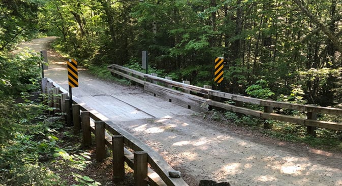
Hancock Notch Trail
The parking area is on a hairpin turn, so I was careful as I crossed the road to access Hancock Notch Trail. I noted how well-used it was before heading down the steps to the trail. Then, with a grin, I tilted my head back and breathed deep gulps of the timberline pine and spruce I love so much. It felt good to be back in the beautiful, rugged White Mountains.
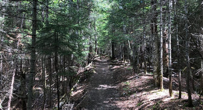
The trail was well-pounded dirt, and the first few miles were easy as I stepped around the classic White Mountain roots and rocks. There is not much better hiking on the east coast than in the White Mountains.
Cedar Brook Trail
As I turned left onto the Cedar Brook trail, I glanced up the Hancock Notch trail to my right. I would be finishing the Desolation Loop on that trail and remember thinking it looked much more rugged than the hard-packed dirt I was currently hiking on. AThedark, leaning in over the narrow, shadowed trail, looked a little ominous.
Cedar Brook was the same rocky, rooty trail, and I moved quickly towards my first highlight of the Desolation Loop. I was going to hike the Hancock Loop Trail and was looking forward to climbing the three Hancock 4,000-footers. It was a beautiful day with bright blue skies, white cloud puffs floating overhead, and low temperatures.—a perfect day for climbing.
Hancock Loop Trail
I did not get to the Hancock Loop Trail until around 2 PM. Messing around with my new Arc Haul pack in the car had taken longer than I realized. As I started up the Hancock Loop Trail, I began running into all the hikers coming down the mountain. Was I starting too late? The positive side of a late start would hopefully be no crowds at the top!
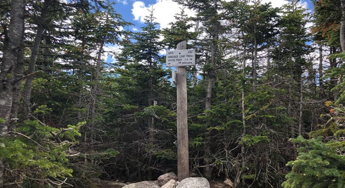
The climb was rocky, and I lowered my head and settled into my stride, finding a regular rhythm as I climbed and pulled myself up the mountain. Finally, I reached the junction for the actual loop at about 3,400 feet. Taking a left, I picked my way down a steep rocky descent before going to the bottom and climbing to Mountain Hancock’s summit.
The climbing was steep, but I did not have to begin using my hands until around 3,600 feet, and this involved grabbing a few roots, rocks, and trees to pull myself up over large rocks on the steep ascent. The last half mile was a good workout, and I smiled as my legs began to burn.
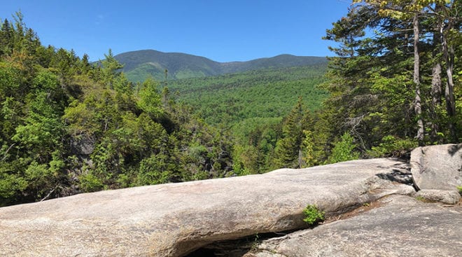
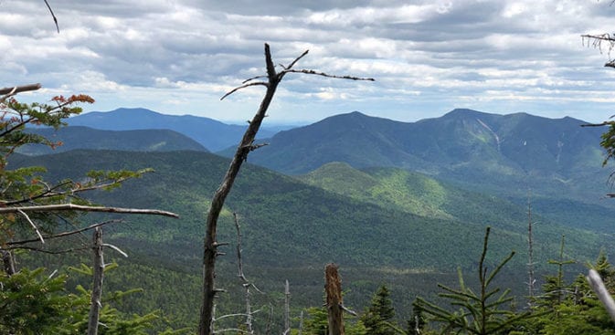
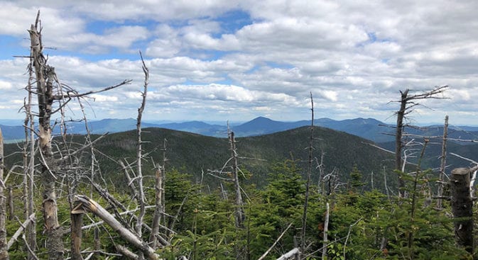
The alpine zone is a favorite of mine. I love the pungent smell of spruce and pine, weaving my way through increasingly stunted trees as I make my way toward the sky above. Views were not some of the best in New Hampshire compared to other White Mountains views. Mt. Hancock was still a beautiful mountain and had expansive vistas to admire.
Making my way over to Middle Hemlock, I arrived at an empty South Hancock Peak, where I found an excellent flat-topped sitting rock and settled down for a late lunch of tortillas and Honey Almond Butter. Unfortunately, a tiny AGGRESSIVE chipmunk demanded I share mixed nuts with him, so I gave up cashew. It was a toll for traveling across his summit.
Cedar Brook Trail
The descent down to Cedar Brook Trail was the same as the ascent up to Hancock Mountain – STEEP! The first half mile was slow and tedious as I picked my way down. I can’t even imagine coming down that in inclement weather. There were sections that, with just a tiny amount of rain, would become treacherous mudslides!
This was also the location of bruise number one. I use Black Diamond hiking poles, but these could not stop me from sliding as my feet shot out from under me on an incredibly steep and sandy trail. Fortunately, there were large, HARD rocks to slam my arms into to stop the slide. Ugh…
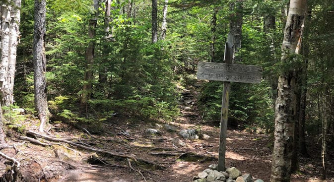
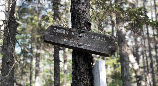
Finally reaching the bottom of Hancock Loop Trail, I took a right and headed down Cedar Brook Trail. Glancing up, I paused to consider the well-worn and slightly crooked Cedar Brook Sign – hinting of the “wilder” trails to come. Most of the trails from here on out would be more rugged and less maintained. This was the wilderness I loved, with less of man’s touch to impact and disrupt.
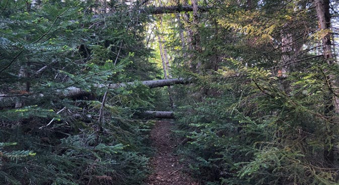
As I moved down Cedar Brook, it became less maintained. Like many trails I would hike over the next two days, the trail was brushy, with blowdowns and boggy, wet areas. In a few instances, the trail had been thoroughly washed away. Nature took back its own quickly, which meant I needed to stay focused and aware of my surroundings as I hiked.
Wilderness Trail
It was almost dark before I stopped for the night, just past the intersection of Cedar Brook Trail and the Wilderness Trail. If you want to cut off over half a day and leave out the loop to Thoreau Falls and Shoal Pond, then you can stay on the Wilderness Trail and hike straight over to Carrigan Mountain. One of the highlights for me was Thoreau Falls. I remembered it from my AT hike and was looking forward to visiting again.
Finding camping was a little more complicated than I had expected. If possible, I like to stay out of sight of the trail I’m hiking on. The Pemigewasset River on my left, and the mountains on my right, made for a narrow corridor. Even when I moved away from the river, the woods were dense with low-lying wet ground.
There were few options, and it was getting dark, so about a quarter of a mile up the Wilderness Trail, I finally turned off into the woods and found a small, cprecisearea to set up my Altaplex Tarp tent. Clear is probably the wrong word – more like “open.”
The ground was covered in small saplings, rocks, and debris, and I moved fast to try and clear some space as it grew darker. Everything was by feeling and memory by the time I had begun to set up my shelter. Swarms of mosquitoes had descended upon me when I quit moving, and I did not want to stop to dig out my headlamp. Thankfully, I know my gear well enough to set up with my eyes closed.
Desolation Loop – End of Day
I was tired, and once I had settled in for the evening, I ate a couple of bars and curled up under my Katabatic Flex quilt. The quilt was new, and temperatures were cooling off quickly. I was interested in seeing how the quilt performed in cooler temperatures. Unfortunately, my Neoair pad made the rocks and debris non-existent, and I began drifting off quickly.
Nights in the forest are peaceful. I listened as small animals began to come alive around me. They had stayed hidden while I invaded their world, but now tiny, quick steps let me know they were starting to venture out to investigate the intruder. While I slept, their more prominent friends would probably also come to take a look.